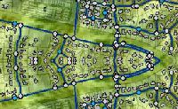
WaterGEMS
WaterGEMS is a hydraulic modeling application for water distribution systems with advanced interoperability, geospatial model building, optimization, and asset management tools. From fire flow and constituent concentration analyses, to energy consumption and capital cost management, WaterGEMS provides an easy-to-use environment for engineers to analyze, design, and optimize water distribution systems.
...more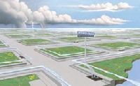
StormCAD modeling software
StormCAD is a comprehensive modeling software program for the design and analysis of storm sewer systems. StormCAD provides calculations for catchment runoff, inlet capacity, and gutters and pipe network flow.
...more
STAAD.Pro V8 i element analysis software
STAAD.Pro V8 i is a comprehensive and integrated finite element analysis and design offering, including a state-of- the-art user interface, visualization tools, and international design codes. It is capable of analyzing any structure exposed to static loading, a dynamic response, wind, earthquake, and moving loads. STAAD.Pro V8 i is the premier FEM analysis and design tool for any type of project including towers, culverts, plants, bridges, stadiums, and marine structures
...more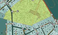
SewerGEMS software
From urban sewer planning to overflow remediation analysis to optimized best management practices designs, SewerGEMS provides an easy-to-use environment for engineers to analyze, design, and operate sanitary or combined conveyance sewer systems, using built-in hydraulic and hydrology tools, and a variety of wet-weather calibration methods.
...more
rm Bridge
Product Family Brochure rm Bridge 2D3D4D Bridge Design, Analysis, Fabrication, and Construction RM Bridge V8 i is comprehensive software for structural design and analysis. It supports today’s ad- vanced understanding of bridge building to produce accurate, dependable results for all bridge types, classes, and materials. The software streamlines typically massive analytical tasks, handling complex engineering issues while enabling users to achieve substantial time savings.
...more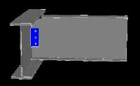
RAM Connection V8 i element analysis softwareSystem
RAM Connection V8 i can be used as a stand alone program or fully integrated with RAM Structural System V8 i , RAM Elements, and STAAD.Pro ® V8 i for steel connection design. RAM Connection V8 i provides powerful connection check or design in seconds. To check a specific connection, design a single connection for multiple joints or optimize each connection in your structure, RAM Connection V8 i gets you there quicker than ever before.
...more
ram concept
No matter how complicated, an entire elevated slab or mat foundation can be designed more effi- ciently using RAM Concept. It easily accounts for steps, slabs, mats, openings, complicated loadings, and other irregularities. Developed for reinforced or post-tensioned slabs and mats, RAM Concept will save you time and money in the design of concrete structures. RAM Concept links with RAM Structural System and STAAD.Pro ® , which allows engineers to perform gravity and lateral analysis and design on multi-story 2-way slab (post-tensioned or mild reinforced) concrete buildings.
...more
Power Rail Track
Power Rail Track is a comprehensive application for preliminary and detailed 3D design of rail infrastructure. The software provides complete drafting capabilities, powerful mapping tools, and a high degree of automation to established industry workflows, to deliver significant pro- ductivity improvements and time savings for design and maintenance of rail projects.
...more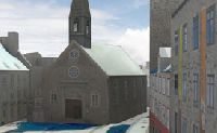
Bentley Map V8 i
Bentley Map is a fully featured GIS that is intrinsically 3D. It is designed to address the unique needs of organizations that map, plan, design, build, and operate the world’s infra - structure. Bentley Map supports the creation, maintenance, analysis, and sharing of 2D and 3D geospatial information. It is also ideal for developing custom GIS applications
...more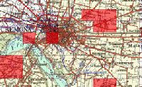
Bentley Geospatial Server
Bentley Geospatial Server, the centerpiece of Bentley’s GIS architecture, brings together information in spatial databases, drawings, business documents and other forms through a unique Federated In- formation Management approach based on indexing. Information in enterprise databases, legacy and departmental systems, and project-based data in virtually any format is accessible to users through a spatial interface. Bentley Geospatial Server also supports extensive printing and plotting functions.
...more
Logitech Keyboard K120

Brother Hl-1111 Laser Printer

HP LaserJet Pro CP1025 Color Printer

Intex Portable Speaker

iBall Portable Speaker

Intex Speaker

dsl router

D Link 24 Port

LED LG Monitor

USB TV Stick Claro TV

Ram DDR 1

Agro Products
Be first to Rate
Rate This