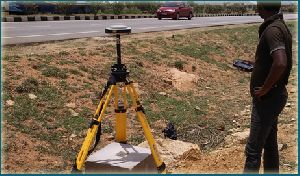
road survey services
Get Price Quote
All those who are looking for a dependable for completing road survey requirements, can get in touch with us. At Latest Cads & Graphics, we are a group of professionals, associates, surveyors and analysts, who work together to provide road survey services. We are operating from Gurgaon (Haryana, India) and provide data relevant to shape, gravitation, elevation and land features. Besides, we verify the accuracy of survey data prior to providing complete report, making it convenient for the clients.

road survey
Get Price Quote
We are renowned as one of the prominent Service Providers engaged in conducting the professional Road Survey as per the set rules and industry standards. The Road Survey is performed by our expert professionals, who have years of experience in this field. By using the advanced equipment and techniques, we ensure accurate Road Survey Report. The Road Survey Service can be availed from us at the most competitive rates.
Looking for Road Survey Service Providers

Road Surveyor
4,000 - 8,000 Per Kilometer
A road survey is a comprehensive assessment and mapping of the terrain, topography, and surrounding environment along a designated route for the purpose of planning, designing, and constructing a road. This type of survey is a fundamental step in the development of transportation infrastructure, providing critical information for engineers, planners, and construction teams to ensure the effective and safe construction of roads. Key components and features of a road survey include: Route Analysis: Surveyors analyze and determine the most suitable route for the road, taking into consideration factors such as terrain, geological conditions, environmental impact, and existing infrastructure. Topographic Mapping: Detailed topographic maps are created to illustrate the existing features of the landscape, including elevation changes, water bodies, vegetation, and other elements that may influence road design. Geodetic Control: Establishing precise geodetic control points to ensure accurate measurements and alignment of the road with broader geospatial frameworks. Alignment and Profile Design: Surveyors design the horizontal alignment (curvature) and vertical profile (slope) of the road to optimize safety, efficiency, and adherence to engineering standards. Cross-Section Surveys: Conducting cross-sectional surveys along the road route to determine the shape and dimensions of the roadbed, embankments, and cuttings. Traffic Analysis: Assessing existing and projected traffic conditions to design roadways that meet capacity and safety requirements, including considerations for intersections, turning radii, and traffic flow. Subsurface Exploration: Investigating soil conditions and conducting geotechnical surveys to assess the stability of the roadbed and provide information for pavement design. Utility Coordination: Identifying and coordinating with utility providers to locate existing underground utilities and plan for their relocation or adjustment to avoid conflicts during construction. Environmental Impact Assessment: Evaluating the potential environmental impact of the road construction, including considerations for wildlife habitats, water resources, and other ecological factors. Construction Layout: Providing accurate survey data during the construction phase to guide the placement of road elements, such as lanes, shoulders, medians, and signage. Road surveys play a crucial role in ensuring the efficient, safe, and sustainable development of transportation networks. The information gathered during these surveys forms the basis for informed decision-making throughout the planning, design, and construction phases of road infrastructure projects.

Road and Railway Engineering survey
Get Price Quote
Road and Railway Engineering survey: * feasibility study, new route selection, preliminary and final location survey and land acquisition. * establishment of gps stations. * carrying out closed traversing along the highways using electronic total station and distribution of closing errors with least square method. * carrying out detailed topographical survey for all surface features, ground levels,longitudinal and cross section profiles and plotting the drawing in autocad format. * preparation of detailed project report and drawings. * setting out of coordinates during the time of civil construction and taking as built survey of the same and submitting to the client.

road survey
Get Price Quote
road survey, Topographic Survey, Cadastral Surveys Services

road survey
Get Price Quote
road survey, Topographic Survey, dgps survey, contour survey

road survey
Get Price Quote
road survey, papad khar, High Rise Building Construction Survey

road survey
Get Price Quote
road survey, land surveyor, rail survey service, building survey

road survey
Get Price Quote
road survey, land survey consultancy service, Topological Survey Services

road survey
Get Price Quote
road survey, land survey, dgps survey services, Topographical Survey

road survey
Get Price Quote
road survey, land survey, contour survey, building survey, road survey

road survey
Get Price Quote
road survey, land survey, Topographic Survey, Layout Survey

road survey
Get Price Quote
road survey, Structural Drawing, Topographical Survey, pipe line survey

road survey
Get Price Quote
road survey, Oil Pipelines Route Survey, Topographical Survey

road survey
Get Price Quote
road survey, Topographic Survey, Boundary Survey Services

Road, Rail And Canal Route Surveys
Get Price Quote
Road, Rail And Canal Route Surveys, structural designing service

road survey
Get Price Quote
road survey, Railway Line Survey, Irrigation Planning Services

Cross Section of Road Survey Services
Get Price Quote
Cross Section of Road Survey Services, Cadastral Survey Services

road surveying services
Get Price Quote
road surveying services, gps surveying services, Land Surveying Services

Road, Rail And Canal Route Surveys
Get Price Quote
Road, Rail And Canal Route Surveys