2D & 3D Conversions
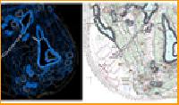
We are providing 2d & 3d conversions service.

Utility Mapping
Major investments need to be made in society’s utility supply lines; water mains, sewage systems, telephone lines, power lines, gas mains, etc. Often the geographic location is recorded on inferior quality maps and in some cases it is not documented at all. Certainty of supply, environmental protection and efficiency of operations, however, require good basic data. Excavation damage can be largely avoided when reliable information regarding location and description of underground utility lines are available. Repair and replacement of utility lines can be carried out in the optimal manner when based on an efficient gisutility mapping system.
...more
remote sensing services
Remote sensing in the broadest sense, the measurement or acquisition of information of some property of an object or phenomenon, by a recording device that is not in physical or intimate contact with the object or phenomenon under study; e.g., the utilization at a distance (as from aircraft, spacecraft, or ship) of any device and its attendant display for gathering information pertinent to the environment, such as measurements of force fields, electromagnetic radiation, or acoustic energy. The technique employs such devices as the camera, lasers, and radio frequency receivers, radar systems, sonar, seismographs, gravimeters, magnetometers, and scintillation counters.
...more
Point Cloud Modeling
We are offering point cloud modeling.

mapping
We are offering parcel/cadastral/mapping. Parcel maps facilitate administration, zoning, flood determination, real estate, service territories, financial services, tax, utilities, building and site development, lake and stream erosion control, planning, design and construction of roads, public works etc. Understanding actual parcel boundaries significantly improves the positional accuracy of property location. Positional accuracy is a measurement how close are the property location features representingthe true position on earth. Knowing actual parcel boundaries significantly improves the accuracy of parcel data.
...more
data migration services
We are offering data migration services. Data migration is the transferring of data between storage types, formats, or computer systems. Data migration is usually performed programmatically to achieve an automated migration, freeing up human resources from tedious tasks. It is required when organizations or individuals change computer systems or upgrade to new systems.
...more
cartography
art and science of representing a geographic area graphically, usually by means of a map or chart. political, cultural, or other non-geographic features may be superimposed.
...more
3D City Mapping
Three-dimensional models of urban environments are useful in a variety of applications. They are typically represented either as Digital Surface Models (DSM) or triangular 3D meshes. A standard technique for obtaining the geometry of a large-scale city area in an automated or semi-automated way is to apply stereo vision techniques on aerial or satellite imagery. DSMs and 3D models can also be obtained from Synthetic Aperture Radar (SAR) or from airborne laser scans Recently, ground-based data acquisition systems have been developed, which are capable of scanning the geometry of building facades as seen from the street level..
...more
Cad Conversion Services

Cad Services

gis services.

marine navigation
We are providing marine navigation service.

Marketing Media
We wre providing marketing media service.
Be first to Rate
Rate ThisOpening Hours