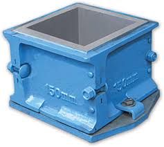
Cube Mould
1,000 Per Piece
6 Piece(s) (MOQ)
cube moulds. The standard size of cube is 150 mm. cubes of 100 mm size are not suitable for concrete having a nominal maximum aggregate size exceeding 20 mm. .. The cube mould is normally made in two halves to facilitate removal of the concrete cube without damage.
Type : Cube Mould
Material : Iron
Shape : box
Application : all
Weight : 4 kg
Color : Blue
Feature : Fine Finishing
Condition : New
Finishing : Polished
Raw Material : CAST IRON
Warranty : 1 Year
Thichness : 10-20mm
Size : NA
Brand Name : neev
Application : civil
Shaping Mode : box
Color : blue
Brand Name : neev
Application : civil
Weight : 4 kg
...more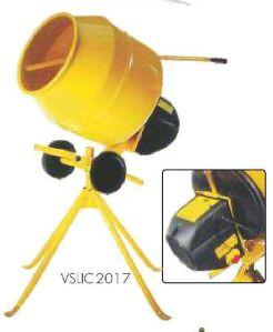
Hand Operated Concrete Mixer Machine
30,000 Per Piece
3 Piece(s) (MOQ)
type : casting concrete mixer machine condition : new specialty : optimum strength color : yellow power source : engineour esteemed customers can avail from us an excellent quality collection of concrete mixer hand operated. we are providing these mixer in various specification to fulfill the demands of our clients. Owing to sound infrastructure facilities, the offered products are monitored in terms of quality. These products are anti-corrosive, long lasting and reliable in nature. These products are used in construction of buildings, houses, road and other construction purposes.
Type : Hand Operated Concrete Mixer, Hand Operated Concrete Mixing Machine
Certification : ISO 9001:2008
Weight : 400-500kg
Color : yellow
Condition : New
Automatic Grade : Manual
Warranty : 1year
Driven : hand operated
Brand Name : neev
Charging Capacity : 1 tan
Discharge Way : 1 tan
After-Sales Service Provided : no
Color : yellow
...more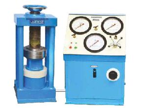
compression testing machine (Electrically operated)
57,000 Per Piece
1 Piece(s) (MOQ)
Electrically Operated Compression Testing Machine (CTM) is an electric cum hand operated machine for performing compression tests on concrete specimens up to 20 cm dia and 30 cm in height. The machine meets the essential requirements of various Indian, British & American standards for compression tests . The load frame is made up of high quality steel conctruction with a fixed. upper lead carrying a ball seated plate.1- Extra guages can be attached to the machine(max.3 nos.), for betteraccuracy and results.2- Electrical connection can be either single phase on 200 V.A.C.,or 3 phase 440 V.A.C.3- Rectanguler plates of various size on request.4- Digital load indicater with pressure transducer can be supplied at extra cost.
Type : Automatic Compression Testing Machine
Application : both
Color : Blue
Feature : Good Strength
Voltage : 220V
Condition : New
Finishing : Polished
Packaging Type : Wooden Box
Power Source : Electric
Load Weight : 100kg
...more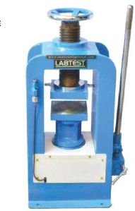
Compression Testing Machine
30,000 Per Piece
2 Piece(s) (MOQ)
the basic principle behind working with the tablet compression machine is the hydraulic pressure. The pressure is been transmitted via static fluid to all directions in the same proportion. Multiple force is also been applied if needed. product type : cube compression testing machine condition : new application : industrial resistivity : rust resistant durability : long life performance : optimum operation : easy features : corrosion resistance durable finish reliable service life
Type : Cube Compression Testing Machine
Certification : ISO 9001:2008
Application : Testing Material
Weight : 400-500kg
Color : Blue
Voltage : No
Automatic Grade : Hand Operated
Power : 9-12kw
Driven Type : Hand Operated
Warranty : 1year
Color : blue
...more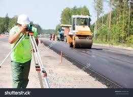
Topographical Survey
8,000 Per 0
4 Kilometer (MOQ)
a highway survey can be used to provide an accurate layout of the road, utilities, drainage, overhead wires, nearby buildings, and other features.surveying or land surveying is the technique, profession, art and science of determining the terrestrial or three-dimensional positions of points and the distances and angles between them. A land surveying professional is called a land surveyor. These points are usually on the surface of the earth, and they are often used to establish maps and boundaries for ownership, locations, such as building corners or the surface location of subsurface features, or other purposes required by government or civil law, such as property sales.
...more
Rail Corridor Observation survey services
8,000 Per 0
5 Kilometer (MOQ)
Railways throughout the world differ dramatically in size, type of operation and the environment in which they operate, yet all are asset-intensive corridors. Geo Adithya asset mapping services provide customers with the information needed to ensure the safe and uninterrupted operation of railway corridors. Recognizing that construction, modification and maintenance of railway corridors add to operating expenses for rail operators, Geo AdithyA has developed a unique combination of technologies to provide cost-effective solutions that assist railway operators in managing their valuable right-of-way assets from city centers to remote rural areas.Geo AdithyA Rail Corridor Observation and Reporting program use leading-edge technology to gather field data during regularly scheduled airborne or rail car surveys. High-resolution digital images and other sensors acquire continuous coverage of the right-of-way, providing updated geo-referenced datasets from every mission. Once processed and compared to previous data, our fast and automated change detection software highlights areas of concern for more detailed analysis, providing our clients with the most recent dataset to maintain the currency of their in-house or web hosted GIS.
...more
soil survey
2 Kilometer (MOQ)
Soil survey, soil mapping, is the process of classifying soil types and other soil properties in a given area and geo-encoding such information. It applies the principles of soil science, and draws heavily from geomorphology, theories of soil formation, physical geography, and analysis of vegetation and land use patterns. Primary data for the soil survey are acquired by field sampling and by remote sensing. Remote sensing principally uses aerial photography, but LiDAR and other digital techniques are steadily gaining in popularity. In the past, a soil scientist would take hard-copies of aerial photography, topo-sheets, and mapping keys into the field with them. Today, a growing number of soil scientists bring a ruggedized tablet computer and GPS into the field with them. The tablet may be loaded with digital aerial photos, LiDAR, topography, soil geodatabases, mapping keys, and more.
...more
rail survey
8,000 Per 0
4 Kilometer (MOQ)
railways throughout the world differ dramatically in size, type of operation and the environment in which they operate, yet all are asset-intensive corridors. Geo adithya asset mapping services provide customers with the information needed to ensure the safe and uninterrupted operation of railway corridors. Recognizing that construction, modification and maintenance of railway corridors add to operating expenses for rail operators, geo adithya has developed a unique combination of technologies to provide cost-effective solutions that assist railway operators in managing their valuable right-of-way assets from city centers to remote rural areas.geo adithya rail corridor observation and reporting program use leading-edge technology to gather field data during regularly scheduled airborne or rail car surveys. High-resolution digital images and other sensors acquire continuous coverage of the right-of-way, providing updated geo-referenced datasets from every mission. Once processed and compared to previous data, our fast and automated change detection software highlights areas of concern for more detailed analysis, providing our clients with the most recent dataset to maintain the currency of their in-house or web hosted gis.
...more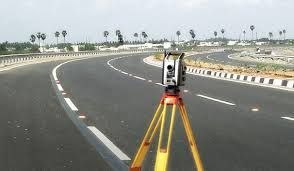
highway survey
4 Kilometer (MOQ)
engineering surveys for highway location:- the surveys to be carried out are: map study: - with the help of topographic map it is possible to suggest the likely routes of the road. .. The main features like rivers, hills, valleys, etc., are also shown on these maps. Reconnaissance: - it is a rapid and rough survey. instrument:topographicapplication:total stationusage:find levels
...more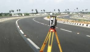
highway survey
4 Kilometer (MOQ)
Highway surveying is a specialized type of land surveying generally conducted for government agencies during the planning stages of a highway development project. ... Often the goal of this survey is to determine the appropriate route where the least amount of land will need to be moved
...more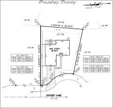
Boundary Survey
4 Kilometer (MOQ)
Surveying has occurred since humans built the first large structures. In ancient Egypt, a rope stretcher would use simple geometry to re-establish boundaries after the annual floods of the Nile River. The almost perfect squareness and north-south orientation of the Great Pyramid of Giza, built c. 2700 BC, affirm the Egyptians' command of surveying. The Groma instrument originated in Mesopotamia (early 1st millennium BC). The prehistoric monument at Stonehenge (c. 2500 BC) was set out by prehistoric surveyors using peg and rope geometry.
...moreBe first to Rate
Rate ThisOpening Hours